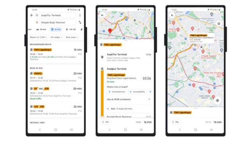
Here’s how to use Google Maps to track bus timings in Delhi:
- Open Google Maps app on your Android or iOS device
- Enter your destination and tap the ‘Go’ icon or Tap the ‘Go’ icon and enter the ‘Source’ and ‘Destination’ locations. If it’s not already selected, tap the ‘transit’ icon (the little tram) to view times, bus numbers, routes and real-time arrival information highlighted in green or red.
- Tapping a recommended route lets you view more information on the route’s stops
- Tap the bus stop to see a listing of all arriving buses, where relevant real-time info is depicted by the green or red beacon.

It is also possible to access real-time bus information by searching for a particular bus stop, tapping its name and its listed bus numbers. You will then see a listing of all buses arriving, with the location-enabled buses displaying their real-time ETA. This feature is also available in Hindi, so users can navigate the trip in their preferred language. They can change the language in Google Maps settings or within the device language settings.
With this new feature you can get information about which bus to catch and you will get to see when the next bus is actually arriving at your stop. Google Maps will also give an estimation of how long your trip is going to take, and if your bus is delayed. Google Transit will automatically update the times in line with the new conditions. Arrival times based on real-time information available are marked in green or red on Google Maps.
“With today’s partnership with Google Maps, Delhi joins the league of global cities that seamlessly provides real time information of public transport so that people are able to plan their journeys to the minute. I hope this collaboration will encourage several other transit apps to tap into the open data portal of the Transport department and create innovative solutions to make Delhi’s public transport system the default choice for everyone,” said Delhi Transport Minister Kailash Gahlot.
timesofindia.indiatimes.com
Leave a Reply